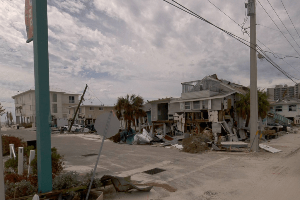
This ground-breaking solution is designed to provide (re)insurers with multi-view imagery to assess damage, following hurricane events. Assuming the pilot goes well, based on client feedback, multi-view imagery will become available on GEO for insurers across the US, including for other Nat Cat perils.
As an industry first, the CAT360 initiative combines ground-level imagery from specialist vehicles and cameras with space and air imagery, onto one single platform. This enables insurers to support their customers to financially recover from catastrophic events as quickly as possible. The objective of CAT360 is to give carriers the ability to proactively respond to customers even before FNOL.
This new and exclusive ground-based 360-degree imagery, which is immediately available to MIS’ beta programme clients and complements other data sources, feeds into carriers’ damage assessment work in the delivery of post-event intelligence via the GEO platform.
Rosina Smith, CPO at MIS, said: “MIS has pioneered the use of satellite and aerial imagery for post-catastrophe damage intelligence. Now, in an exclusive market first, it is trialling ground-based imagery from vehicles equipped with 360-degree, high-resolution cameras with our highly engaged, market representative beta-participants.”
Previously, carriers were only able to access aerial imagery at best, which provided a two-dimensional view of the damage caused. For the first time, CAT360 provides imagery from space, air, and ground in a single platform, combining MIS’ market-leading intelligence and damage classifications with the ability to see property damage from all angles.
Rosina Smith added: “Our on-the-ground data will be available in our market-leading GEO platform, enabling carriers and adjusters to get a street-level view of their affected properties and the wider area following a hurricane. This will enable them to more quickly access their portfolio loss with more accurate reserving, while helping them to allocate the right loss adjusting resources to the right place at the right time to settle claims more quickly and efficiently.”
MIS is constantly testing and evaluating new technologies and partners on behalf of its clients, so they can concentrate on making the best decisions for their customers. CAT360 is its latest innovation to provide the insurance industry with the best intelligence. The initial focus is on hurricanes, but based on feedback it may be rolled out to cover other US Nat Cat perils.
Source: McKenzie Intelligence


